Primelles 18400
Primelles est une commune française située dans le département “Cher” dans la région “Centre-Val de Loire”.
Elle a pour code postal : 18400.
Elle a pour code postal : 18400.
A proximité
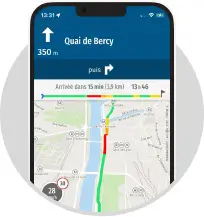
Laissez vous guider par le GPS de l'application MappyInfo trafic, alertes de vitesse et radars

 Top Recherches
Top recherche des internautes
Distances les plus recherchées
- Distance Saint-Florent-sur-Cher Bourges
- Distance Issoudun Saint-Florent-sur-Cher
- Distance Châteauroux Saint-Florent-sur-Cher
- Distance Saint-Florent-sur-Cher Issoudun
- Distance Órgiva Malaga
- Distance Malaga Órgiva
- Distance Saint-Florent-sur-Cher Nantes
- Distance La Chapelle-Saint-Ursin Saint-Florent-sur-Cher
- Distance Barcelone Órgiva
- Distance Saint-Florent-sur-Cher Sainte-Maxime
- Rayon autour de moi
Itinéraires Primelles
Villes à découvrir en France
- Plan Paris
- Plan Marseille
- Plan Lyon
- Plan Saon
- Plan Bailleulmont
- Plan Ladevèze-Rivière
- Plan Nozières
- Plan Leffard
- Plan Le Verguier
- Plan Étrochey
- Plan Courcelles
- Plan Monsures
- Plan Magny-lès-Aubigny
- Plan Bellefond
- Plan Hablainville
- Plan Tanay
- Plan Arriance
- Plan Rémérangles
- Plan Les Plains-et-Grands-Essarts
- Plan Bussu
- Plan Sault-Saint-Remy
- Plan Cauverville-en-Roumois
- Plan Le Ponchel
- Plan Bertrancourt
- Plan Cailly-sur-Eure
- Plan Noailles
- Plan Romain
- Plan Savennes
- Plan Le Plessier-sur-Bulles
- Plan Ville-sur-Tourbe
- Plan Trungy
- Plan Vandeléville
- Plan Boutencourt
- Plan La Chapelle-aux-Chasses
- Plan Saint-Paul-de-Vern
- Plan Portet
- Plan Cheppy
- Plan Vaudeville
- Plan Saâne-Saint-Just
- Plan Guêprei
- Plan Culey
- Plan Santa-Reparata-di-Moriani
- Plan Racécourt
- Plan Stigny
- Plan Serrigny-en-Bresse
- Plan Hugier
- Plan Oléac-Dessus
- Plan Saint-Pierre-du-Mont
- Plan Maîche
- Plan Saint-Claud
- Plan Saint-Sauvy
Lieux à découvrir à Primelles
A découvrir autour de Primelles
Info-trafic en France
Pistes cyclables en France
ZFE en France
 Infos, aide

Actualité
Retrouvez Mappy sur...


Solutions
Accéder aux autres versions de Mappy
A propos de Mappy
Vos questions