Villecelin 18160
Villecelin est une commune française située dans le département “Cher” dans la région “Centre-Val de Loire”.
Elle a pour code postal : 18160.
Elle a pour code postal : 18160.
A proximité
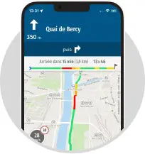
Laissez vous guider par le GPS de l'application MappyInfo trafic, alertes de vitesse et radars

 Top Recherches
Top recherche des internautes
Distances les plus recherchées
- Distance Lignières Châteauroux
- Distance Lignières Saint-Amand-Montrond
- Distance Châteauroux Lignières
- Distance Saint-Amand-Montrond Lignières
- Distance Saint-Leu-la-Forêt Lignières
- Distance Lyon Lignières
- Distance Morhange Lignières
- Distance Lignières Bezons
- Distance Lignières Montpellier
- Distance Lignières Lyon
- Rayon autour de moi
Itinéraires Villecelin
Villes à découvrir en France
- Plan Paris
- Plan Marseille
- Plan Lyon
- Plan Freychenet
- Plan Pradines
- Plan Longchamp-sous-Châtenois
- Plan Lescousse
- Plan Soulages
- Plan Thénorgues
- Plan Foucaucourt-Hors-Nesle
- Plan Champrond
- Plan Euvy
- Plan Froidevaux
- Plan Dricourt
- Plan Saint-Denis-d'Augerons
- Plan Montagagne
- Plan Arget
- Plan Brécy-Brières
- Plan Sère
- Plan Magny-la-Ville
- Plan Peyrefitte-sur-l'Hers
- Plan Bussière-Nouvelle
- Plan Marnaves
- Plan Mornans
- Plan Le Plagnal
- Plan Courtauly
- Plan Sars-le-Bois
- Plan Castex
- Plan Zincourt
- Plan Puttigny
- Plan Aubercourt
- Plan Gémonville
- Plan Champignolles
- Plan Lordat
- Plan Saint-Rémy-aux-Bois
- Plan Dampvitoux
- Plan Villers-devant-Dun
- Plan Berbezit
- Plan Valavoire
- Plan Wegscheid
- Plan Ségura
- Plan Le Gratteris
- Plan Marcieu
- Plan Argers
- Plan Illier-et-Laramade
- Plan Chazelles
- Plan Saint-Jean-de-la-Ruelle
- Plan Flers-en-Escrebieux
- Plan Althen-des-Paluds
- Plan Torcy
- Plan Fontanières
- Plan Ravilloles
- Plan They-sous-Montfort
Lieux à découvrir à Villecelin
A découvrir autour de Villecelin
Info-trafic en France
Pistes cyclables en France
ZFE en France
 Infos, aide

Actualité
Retrouvez Mappy sur...


Solutions
Accéder aux autres versions de Mappy
A propos de Mappy
Vos questions